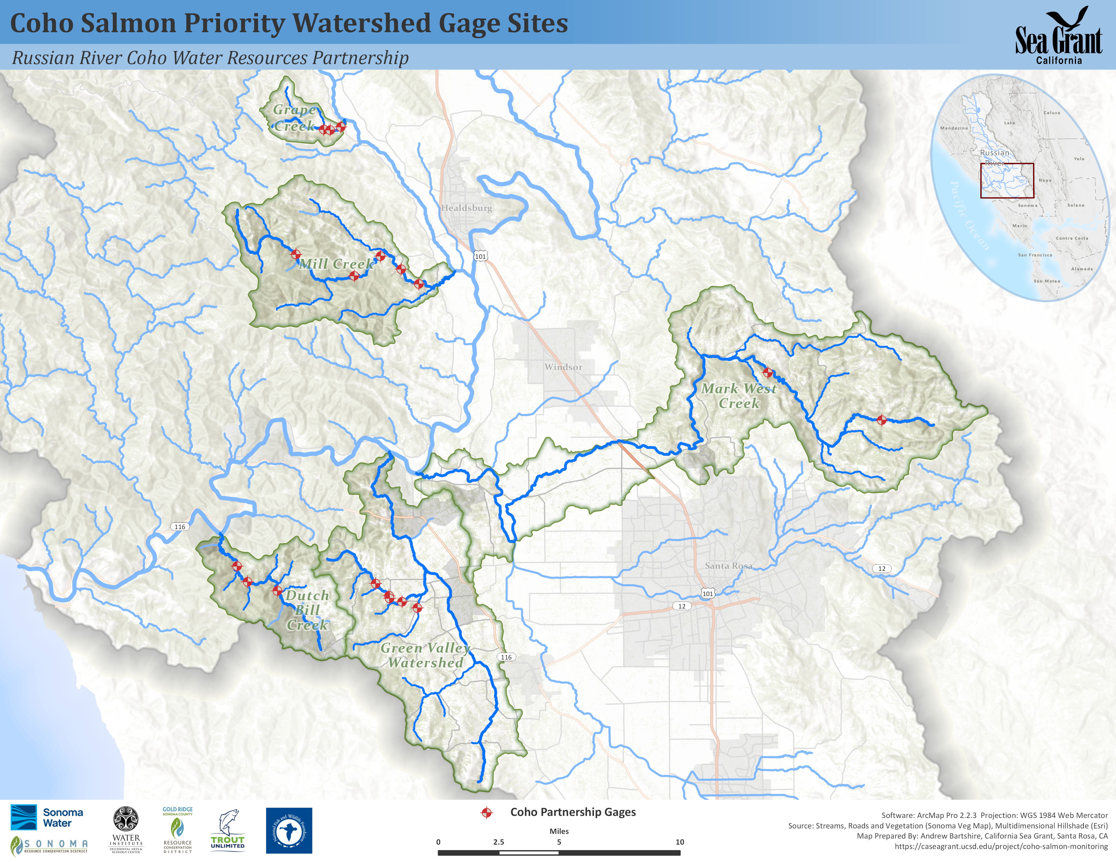
Streamflow data is an essential component for understanding the health of a watershed and the species that dwell within it. Streamflow data provides the foundation needed for many applications and biological analyses, including quantifying the magnitude of impairment caused by water diversions, helping to identify priority reaches for restoration and enhancement projects, estimating the benefit of flow enhancement projects and understanding salmonid survival and recovery. Streamflow data also provides the baseline information needed to understand flow conditions prior to implementation of streamflow enhancement projects and to document the benefits of diversions reductions or water releases on summer streamflow conditions. Coastal California’s dramatic variability in precipitation and streamflow made streamflow monitoring an essential component to the Coho Partnership’s work.
Trout Unlimited’s Conservation Hydrology team (formerly CEMAR), studied the relationships between streamflow conditions and human water use in five project watersheds in Sonoma County since 2010. In the first few years of our work, we investigated the magnitudes, timing, and frequency of high and lows flows in each project watershed to characterize the flow regime of each stream. In more recent years, TU’s work focused on studying low flow conditions during the summer dry season, to investigate the impacts of the recent drought and how water management practices influenced streamflow conditions. Additionally, TU streamflow data was used by our partners to study the timing of significant biological thresholds, such as pool connectivity and over-summer survival.
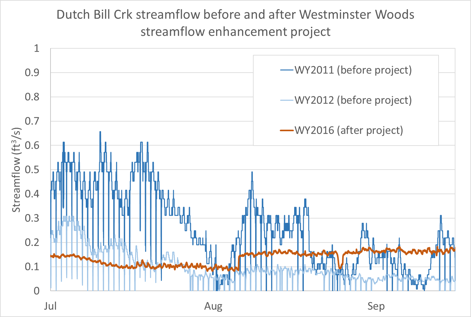
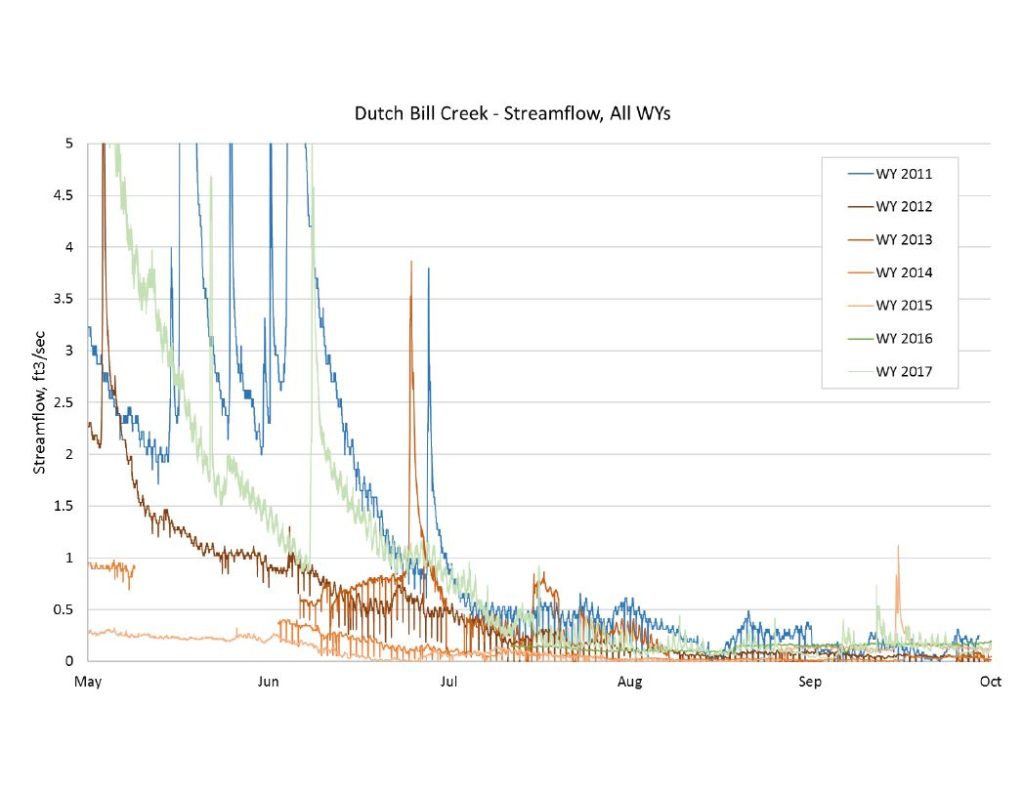
Streamflow data from Dutch Bill Creek before and after the streamflow enhancement project at Westminster Woods.
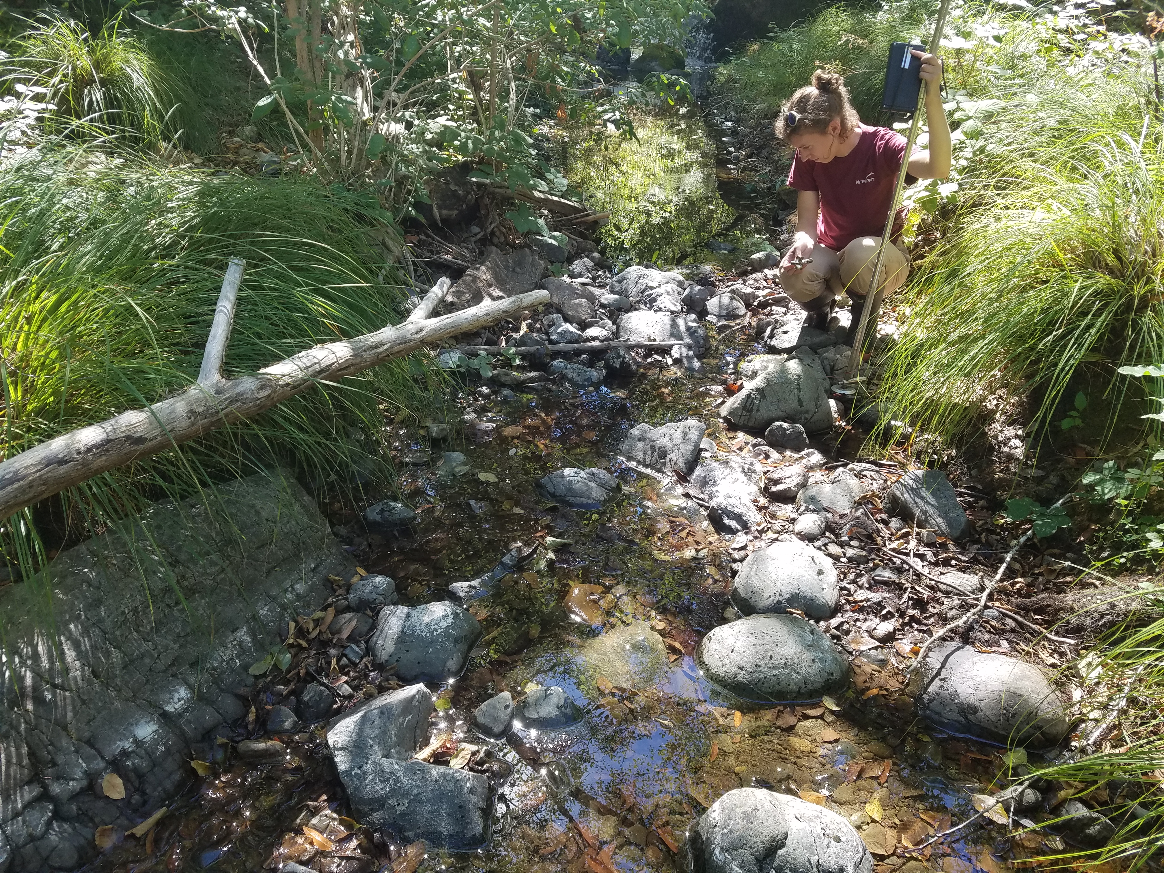
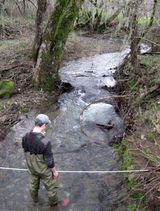
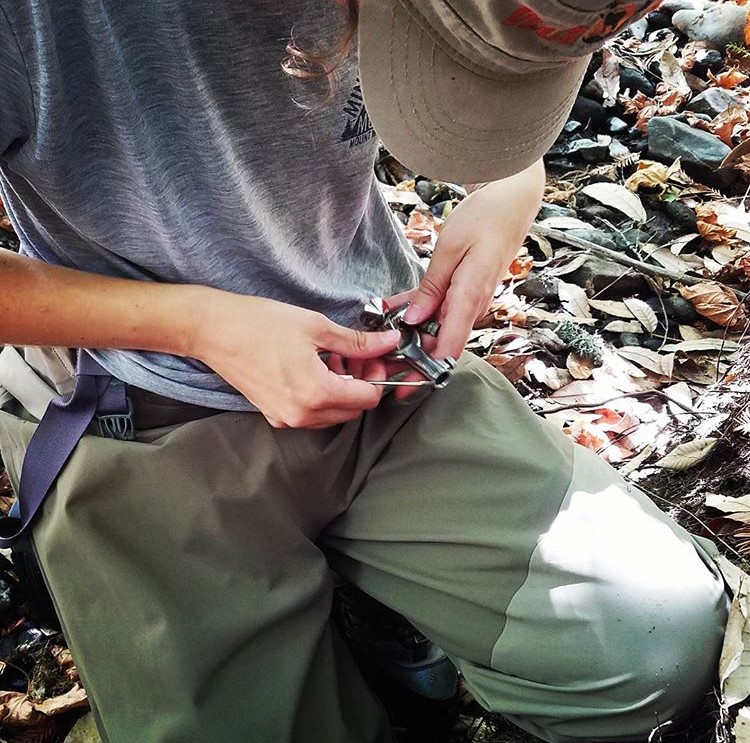
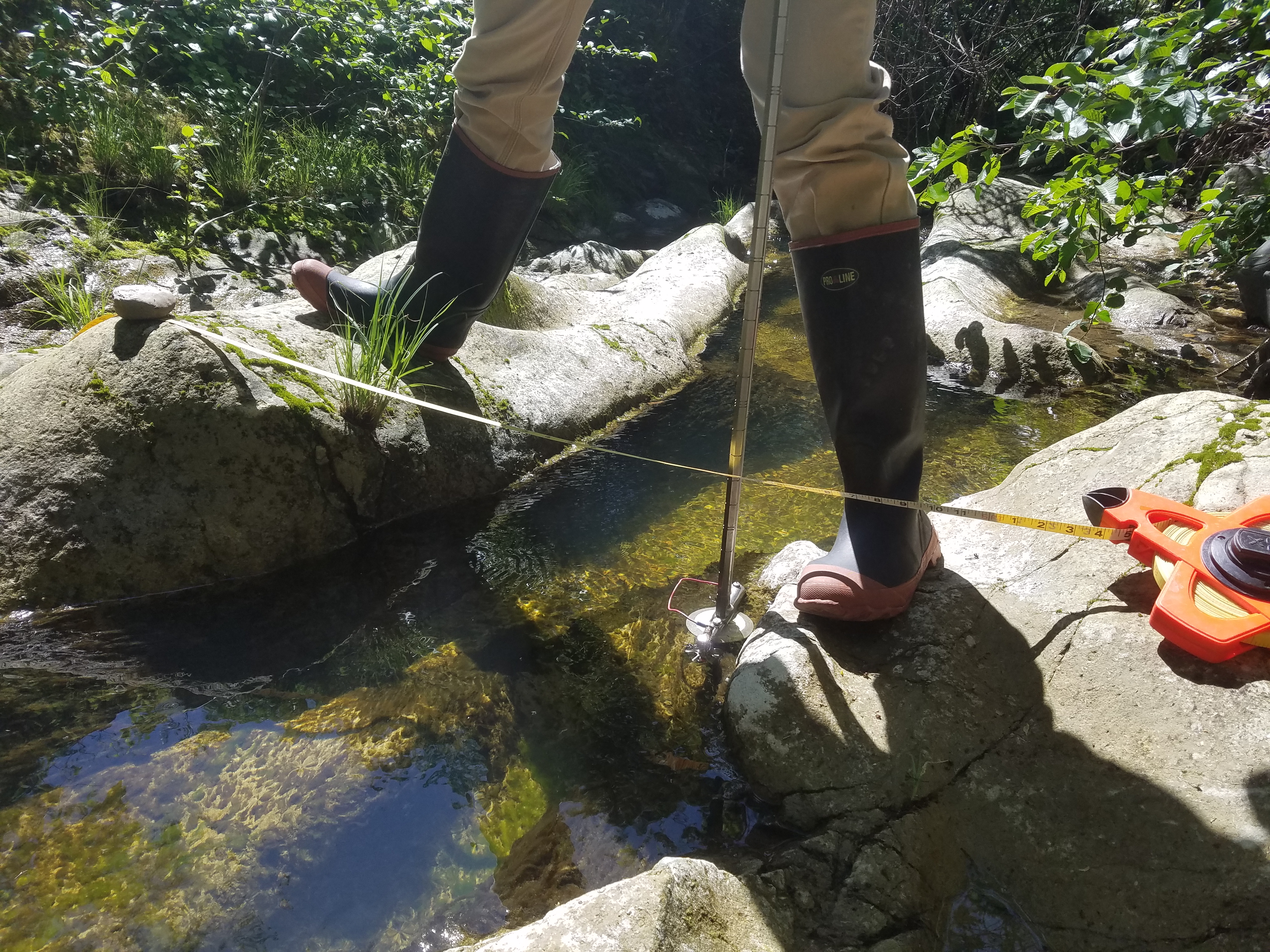
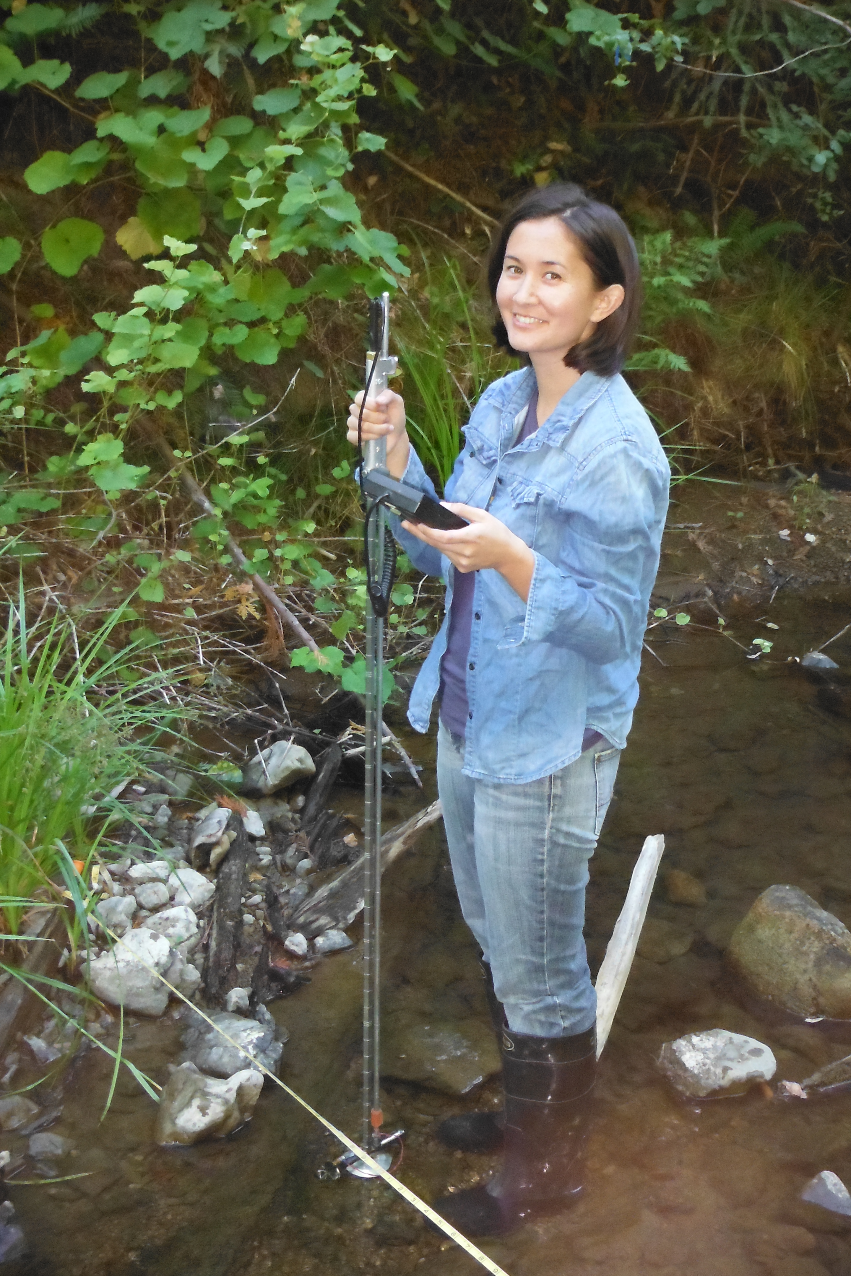
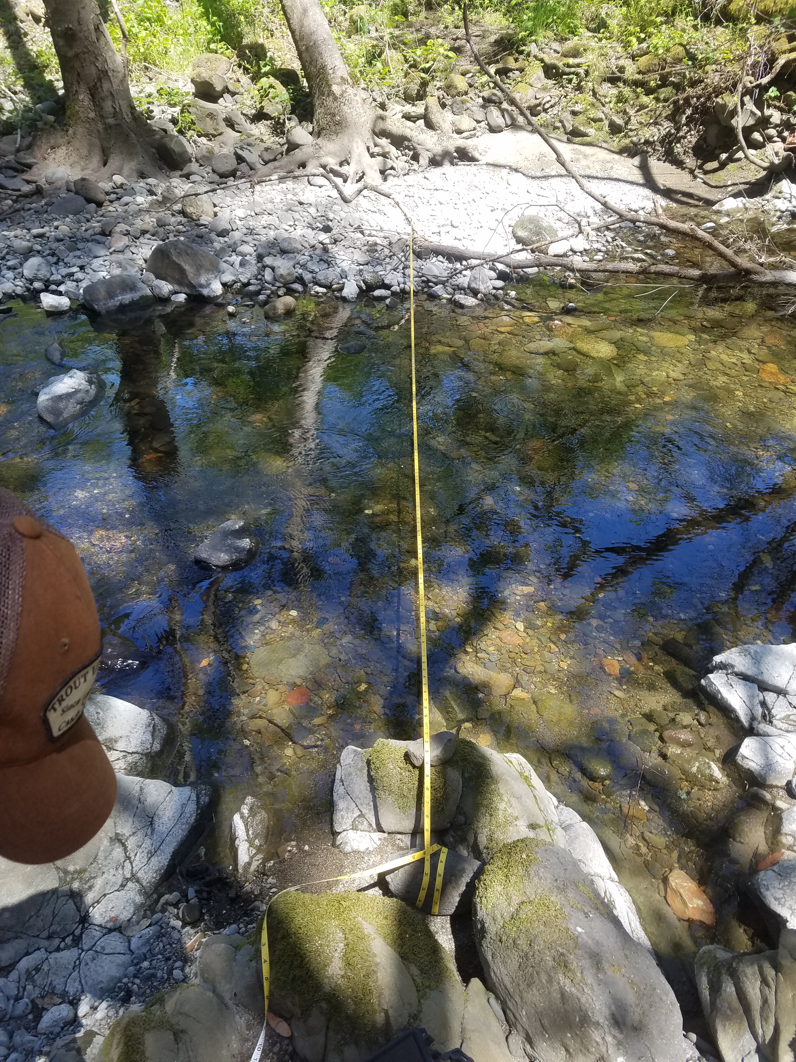
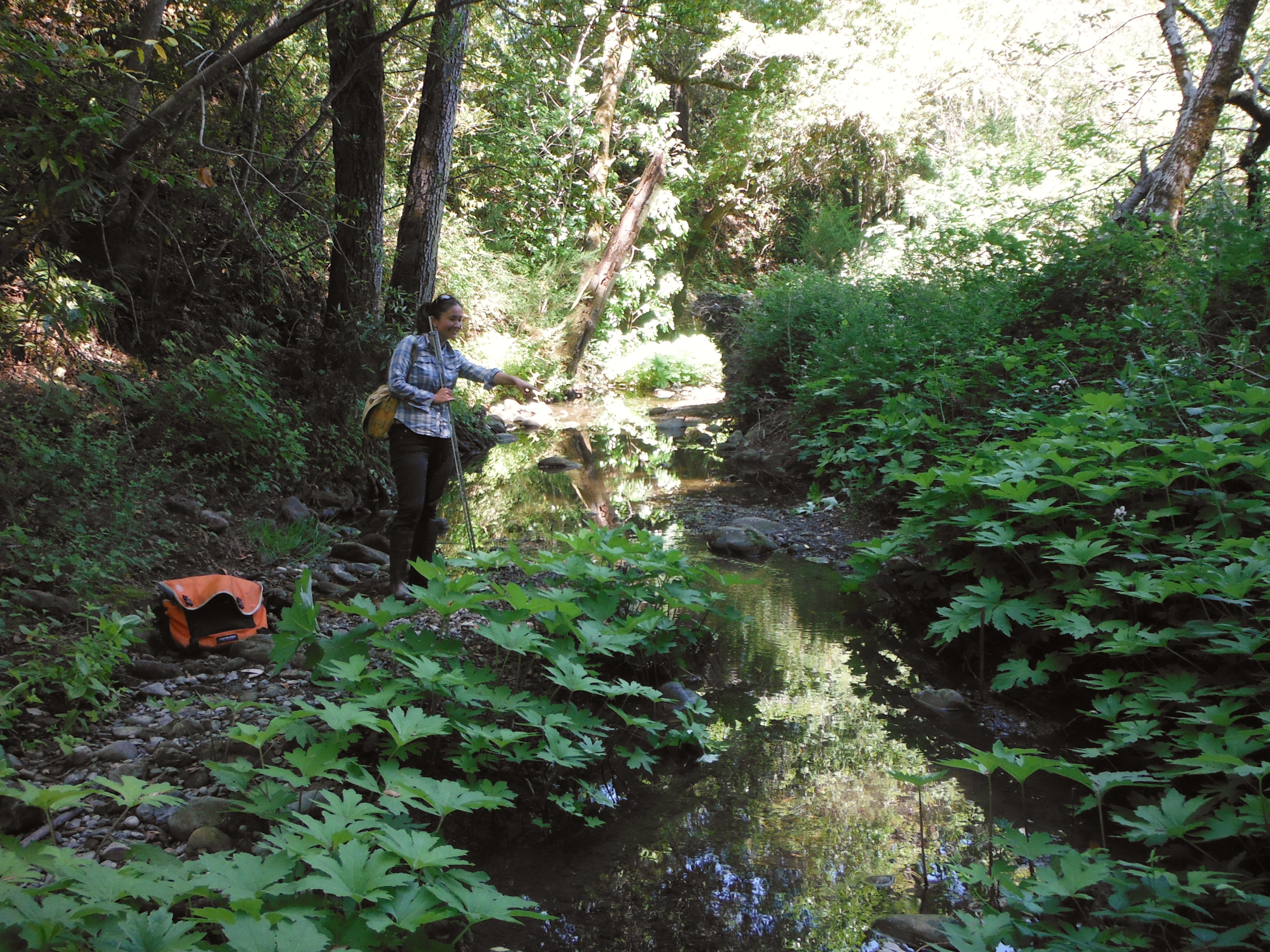
The main components of our work included stream gaging, field data collection, and remote sensing using Geographic Information Systems (GIS).
TU used GIS models to investigate the dynamics of water supply and human water uses for each project watershed. TU’s Cumulative Effects Model (CEM) used water rights data to estimate the cumulative impact of upstream water right diversions on streamflow conditions and to conduct Water Availability Analyses for new water right applications. TU also used remote sensing to estimate human water demands based on digitized land-use and water use estimates. These activities helped the Partnership understand where to prioritize streamflow enhancement projects and the impact human water management activities may be having on streamflow conditions.
Streamflow Data
Streamflow data is critical in developing strategies to address the needs of water users and coho salmon. The Partnership gages provided stream data including water depth, water temperature and streamflow.
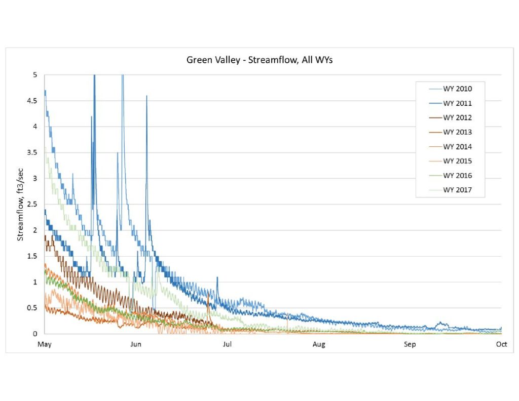
Summer Streamflow Graphs compiled from data collected on each Coho Partnership focus watershed, click on graph to download.
Dutch Bill Creek Summer Streamflow
Green Valley Creek Summer Streamflow
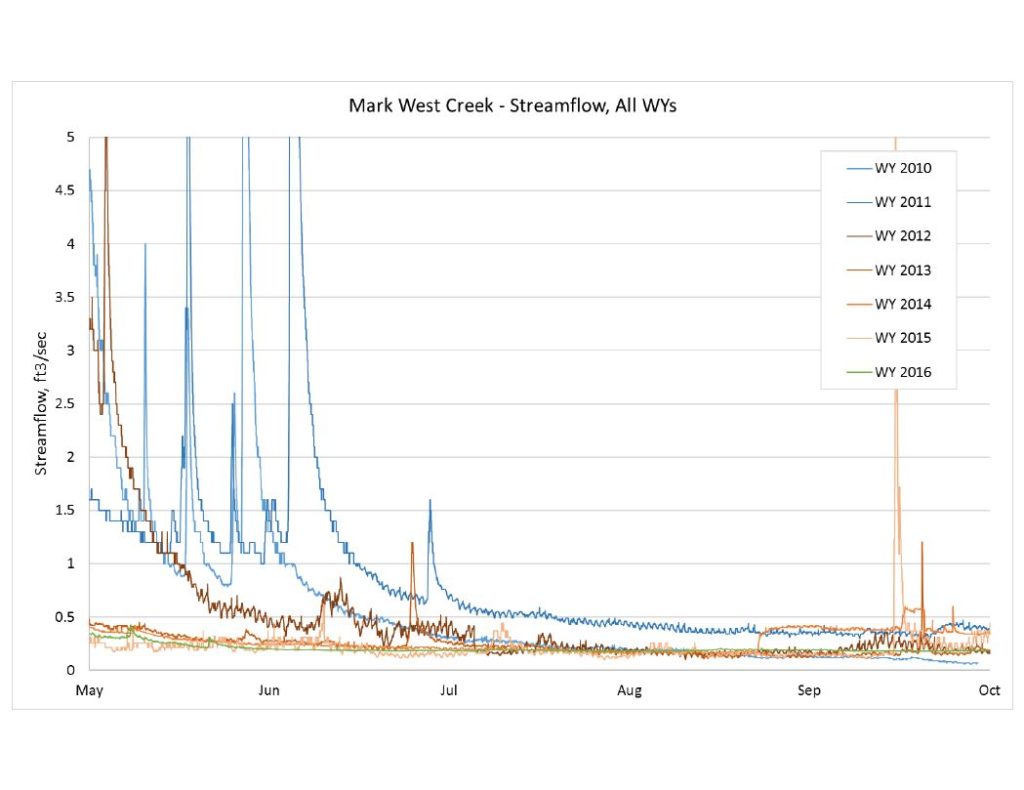
Mark West Creek Summer Streamflow
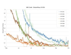
Mill Creek Summer Streamflow
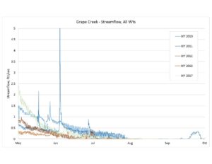
Grape Creek Summer Streamflow
The Coho Partnership sincerely thanks the many private landowners whose support made this research possible.
Images are made available for personal use only and may not be copied, reproduced, or used in any way.
